File:FortCasper Plan.jpg
Jump to navigation
Jump to search
Size of this preview: 496 × 600 pixels. Other resolution: 826 × 999 pixels.
Original file (826 × 999 pixels, file size: 460 KB, MIME type: image/jpeg)
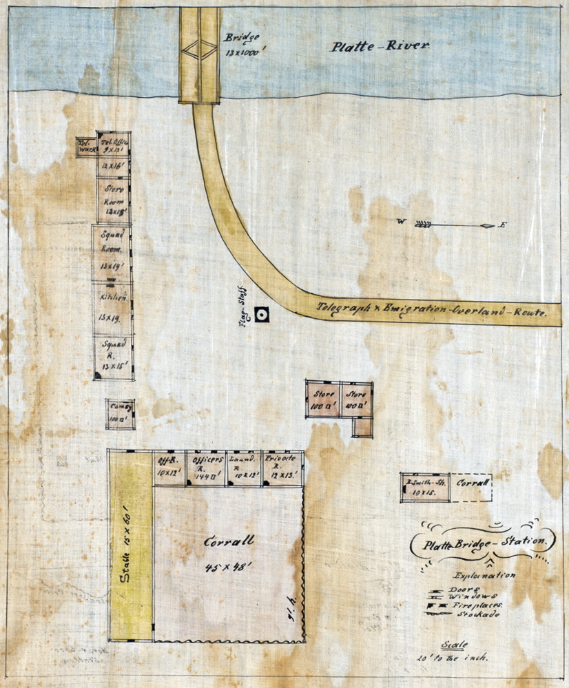
Plan of Platte Bridge Station drawn by Caspar Collins, Original at the Colorado State University Library
Collins, Caspar Wever. "Platte Bridge Station" Caspar Collins Map Collection. 2003. Original Image (16 Jan 2007).
File history
Click on a date/time to view the file as it appeared at that time.
| Date/Time | Thumbnail | Dimensions | User | Comment | |
|---|---|---|---|---|---|
| current | 14:30, 20 May 2007 | | 826 × 999 (460 KB) | FortWikiSysop (talk | contribs) | |
| 20:31, 16 January 2007 | No thumbnail | (460 KB) | FortWikiSysop (talk | contribs) | Collins, Caspar Wever. "Platte Bridge Station" Caspar Collins Map Collection. 2003. [http://lib.colostate.edu/gfr/collins Colorado State University] [http://digital.library.colostate.edu/cgi-bin/pview.exe?CISOROOT=/gfr&CISORESTMP=gfr/html/gfrobjectview.ht |
You cannot overwrite this file.
File usage
The following page uses this file: