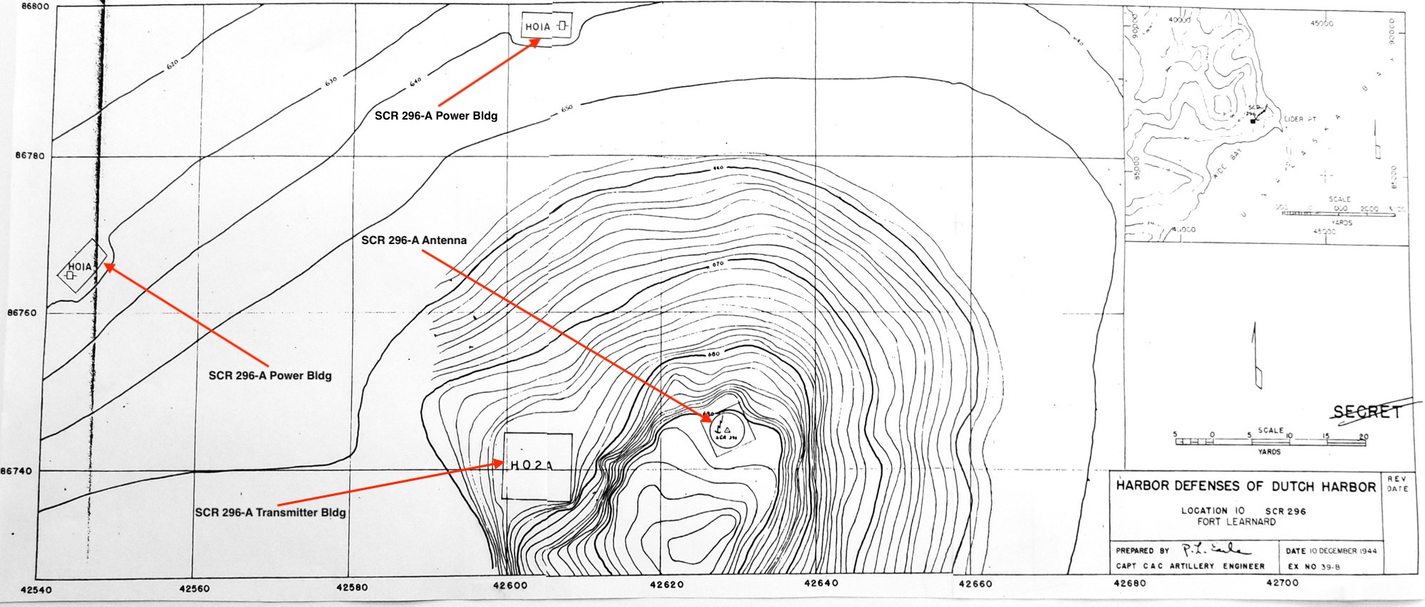
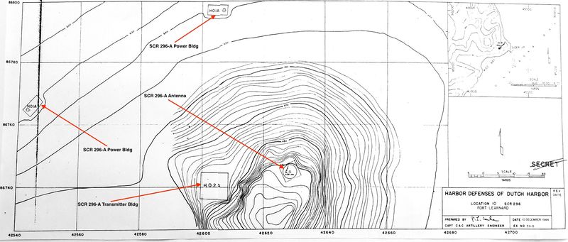
File:Elder Point WWII Radar Site Plan.jpg
Jump to navigation
Jump to search
Size of this preview: 800 × 341 pixels. Other resolution: 2,000 × 853 pixels.
Original file (2,000 × 853 pixels, file size: 395 KB, MIME type: image/jpeg)
Elder Point WWII Radar Site Plan (Annotated), public domain,
- U.S.Army, Supplement to the Harbor Defense Project Harbor Defenses of Dutch Harbor, (SRHDDH), 1944, CDSG
File history
Click on a date/time to view the file as it appeared at that time.
| Date/Time | Thumbnail | Dimensions | User | Comment | |
|---|---|---|---|---|---|
| current | 17:22, 24 January 2019 | | 2,000 × 853 (395 KB) | John Stanton (talk | contribs) | Elder Point WWII Radar Site Plan (Annotated), public domain, {{HBSuppDutch HarborWWII}} |
You cannot overwrite this file.
File usage
The following page uses this file: