File:Baleville RS Plan.jpg
Jump to navigation
Jump to search
Size of this preview: 800 × 568 pixels. Other resolution: 1,000 × 710 pixels.
Original file (1,000 × 710 pixels, file size: 159 KB, MIME type: image/jpeg)
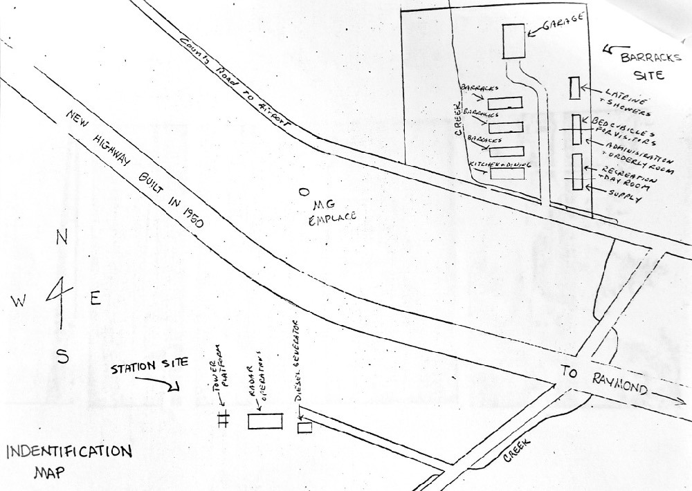
Baleville WWII Radar Site Plan, unattributed sketch at Pacific County Historical Society and Museum, photo by John Stanton 16 Aug 2018
File history
Click on a date/time to view the file as it appeared at that time.
| Date/Time | Thumbnail | Dimensions | User | Comment | |
|---|---|---|---|---|---|
| current | 18:59, 18 August 2018 | | 1,000 × 710 (159 KB) | John Stanton (talk | contribs) | Baleville WWII Radar Site Plan, unattributed sketch at Pacific County Historical Society and Museum, photo by John Stanton 16 Aug 2018 |
You cannot overwrite this file.
File usage
The following page uses this file: