Pyote Air Force Station
|
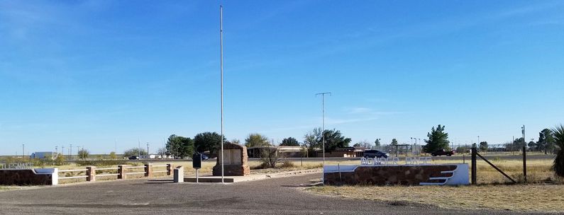
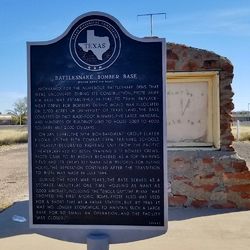
Pyote Air Force Station (1957-1963) - A Cold War Air Force Radar Station first established in 1957 on Pyote Air Force Base near the town of Pyote in Ward County, Texas. Named Pyote Air Force Station after the location. The radar site was initially assigned a Permanent ID of TM-186. Abandoned in 1963. HistoryEstablished in 1957 and became operational in 1959 as Pyote Air Force Station manned by the 697th AC&W Squadron. The station initially had both a Ground-Control Intercept (GCI) and early warning mission. The early warning mission involved tracking and identifying all aircraft entering their airspace while the GCI mission involved guiding Air Force interceptors to any identified enemy aircraft. Controllers at the station vectored fighter aircraft at the correct course and speed to intercept enemy aircraft using voice commands via ground-to-air radio. Initial equipment included the FPS-3A search radar and an FPS-6 height-finder radar. Both radars were mounted on open frame temperate towers without radomes. ClosureOperations were discontinued on 1 May 1963. Pyote AFS and the 697th were deactivated on 1 Aug 1963. Physical PlantThis site was located on what had been during World War II, the Pyote Army Air Base. The base transitioned from the Army to the Air Force in 1947 when the Air Force was created and was named Pyote Air Force Base. The base was in a caretaker status when the radar site was established. The physical plant of the radar site was divided into the main operations site, a cantonment area, a family housing area, and a radio site. Part of the radar site used some existing buildings as a portion of the cantonment area while the operations area, radio site, and family housing area were purpose-built using civilian contractors. It was estimated that the cost of the site was about $2.5 million dollars. The main operations site housed the operations building, the two radar towers, the backup generator building, and the tech supply building. A separate Ground to Air Transmitter/Receiver (GATR) radio site was located a short distance from the main operations site and it housed the radio equipment for directing aircraft intercepts. The operations site was fenced in and had an access road that connected it to the cantonment area and the housing area some five miles away. The Cantonment area housed the enlisted barracks, the bachelor officer's quarters, the orderly room, the dining hall, the motor pool, and other support buildings. Apart from the cantonment area was the small 27-unit housing area for married personnel.
Current StatusAbandoned as a Radar Station and in private hands in Ward County, Texas.
See Also: Sources:
Visited: 26 Nov 2017 Area
| ||||||||||||||||||||||||||||||||||||||||||||||||||||||||||||||||||||||||||||||||||||

