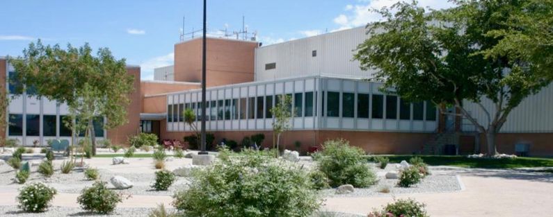
Los Angeles ARTCC
|
Los Angeles ARTCC (1963-Active) - One of 22 Federal Aviation Administration (FAA) Air Route Traffic Control Centers (ARTCC) in the United States. Established in 1963 near Palmdale, Los Angeles County, California. Assigned an FAA ID of ZLA. Active FAA Air Traffic Control Center. Also known as Los Angeles Center. HistoryLos Angeles Center was commissioned 15 Mar 1937 in Burbank, California. Operations were moved to 7th and Flower St. in Downtown Los Angeles in 1943 and then in 1946 to a building on Manchester Blvd south of the Los Angeles Airport. Moved to the present location at 2555 E Ave P, Palmdale in March 1963. The Los Angeles Center covers a part of the FAA's Western service area. The Federal Aviation Administration (FAA) system of 24 FAA Area Control Centers, 20 in the lower 48 United States, one in Alaska, one in Hawaii, one in Puerto Rica and one in Guam. The system operates with radar data provided by FAA radar sites, DoD radar sites, and other federal agency radar sites. These centers provide en route and oceanic services to private, commercial, and military aircraft overflying their respective control areas. As aircraft enter or exit from one control area to the next, responsibility for the aircraft is transferred to the gaining ARTCC. Voice communication between aircraft and the ARTCCs is supported by a network of ground-air radio sites often co-located with the radar sites. The gathering of radar, beacon and other sensor data are now largely automated and continuous, but the actions necessary to control the airspace are conversational and require some 14,000 FAA air traffic controllers talking directly to pilots in the air and on the ground at terminals. This number does not include military air traffic controllers.
Current StatusActive FAA facility in Palmdale, Los Angeles County, California.
See Also: Sources:
Links: Visited: No
| |||||||||||||||||||||||||||||||||||||||||||||||||||||||||||||||||||||||||||||||||||||||||||||||||||||||||||||||||||||||||
