Trinidad WWII Radar Site
|
Trinidad WWII Radar Site (1942-1946) - A World War II U.S. Army Signal Corps Radar Site established in 1942-1943. Used to provide early warning and direction of intercepts of approaching enemy aircraft. Located near the community of Klamath in Del Norte County, California. Deactivated in 1946. Also known as Klamath River WWII Radar Site and Station B-71. HistoryThis radar site was established in 1942-1943 during World War II as a part of a chain of some 65 radar stations along the West Coast of the United States and Canada. These secret radar sites were built to provide early warning and interception of approaching enemy aircraft and ships but also served to assist friendly aircraft that were lost or had in-flight emergencies. This radar network was in addition to the network of search and fire control radars established at each of the West Coast harbor defenses. These West Coast radar stations were established in response to the June 1942 Japanese invasion and capture of the U.S. Aleutian Islands of Attu and Kiska. The islands were both recaptured by U.S. forces and declared secured by 24 Aug 1943. The radar chain was constructed in late 1942 and early 1943 while the Japanese still had control of the islands and had conducted air raids on the U.S. bases at Dutch Harbor. The threat of further air attacks on the West Coast appeared real as did a possible Japanese invasion of the Pacific Northwest. 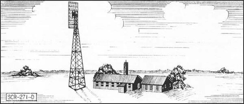 Two types of Air Warning Service (AWS) radar stations were built, long-range search radars (150~ mile range) and short-range Ground Control Intercept (GCI) radars (50~ mile range). The search radars would pick up and track possible enemy aircraft while the GCI radars would guide U.S. interceptor aircraft to these targets. The Trinidad radar site was sited as a search site with a SCR-270-B mobile radar set which was changed out in December 1943 for the SCR-271, the fixed version of the same equipment. There is no indication that the fixed version of the antenna was installed (no sign of the concrete supports that were normally installed). In operation, targets detected by the radar scope operator would be communicated to the adjacent plotting room where they would be tracked on a plotting board and reported by a direct line to a filter station in Berkeley, California. After 1 Jul 1944, the site was used for emergency rescue operations since the threat of air attack from Japan was over. The RC-151 IFF (Identification Friend or Foe) set became the primary detection set for locating friendly aircraft requiring assistance. The radar site was operational from 1943 until 1946. Manning during the active period was typically 45 to 50 men, The site was first operated by a detachment of 653rd Signal Aircraft Warning Company, 4th Air Force (note: the detachment numbers and unit designation changed several times while the site was active). Initial manning consisted of 41 enlisted men and 2 officers. Security was provided by 8 to 20 enlisted personnel and one officer from the National Guard. 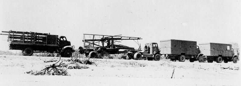
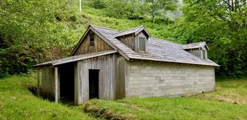
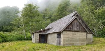
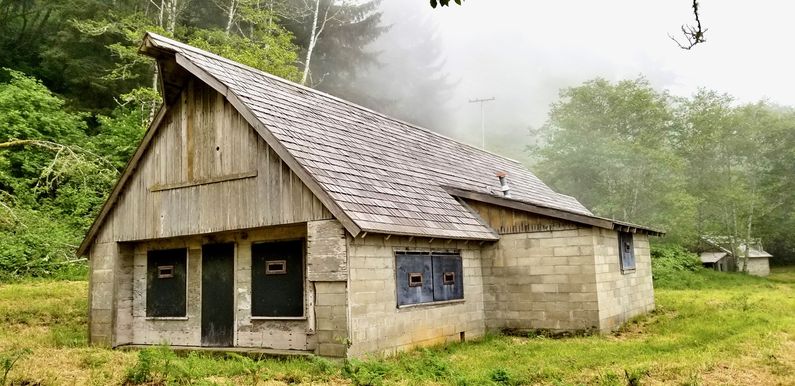
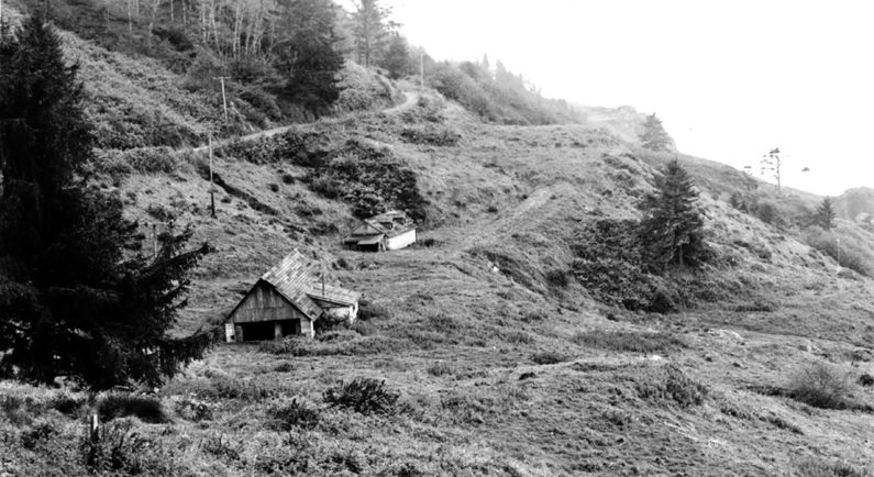
Physical PlantThis installation was a split site with the radar operations area separate from the cantonment area. Both sites were located off present-day Coastal Drive. The cantonment area was about a half mile south of the operations area situated on a relatively flat area overlooking Coast Drive below. A short access road on the east side of Coast Drive led up to the cantonment area. The operations area was located on the west side of Coastal Drive on a lower level than that road. A short access road led down from the Coast Drive to the operations area below. The operations area was built to resemble typical ranch style buildings in the area even to the point of creating false dormers, windows, and doors. There were two major buildings, a radar operations building and a powerhouse. Additional structures included an outhouse, a guard shack at the entrance and three 50 cal. anti-aircraft machine gun emplacements. The anti-aircraft positions featured anti-aircraft gun mounts and large circular sandbagged emplacements. The powerhouse was the smaller of the two buildings and was built to resemble a frame residence with two front-facing dormers and fake windows and doors. It was, in fact, a windowless concrete block building with an "L" shaped entryway. This building housed two motor-generator sets that supplied power to the radar operations building. 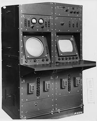 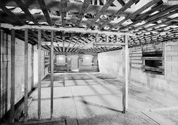 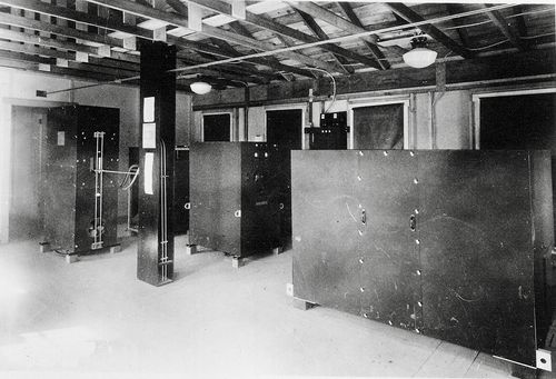 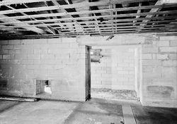 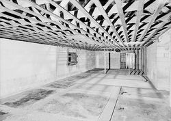 The radar operations building was disguised as a barn with false windows, entryways and even had overhanging pulley support. This building was also a windowless concrete block building with an "L" shaped entryway. The north end of this building housed the radar transmitter and receiver equipment. The interior of the building was most likely partitioned to provide a duty officer office, crew rest area, operator positions, and plotting area. At the beginning of the war, the SCR-270 was a primitive radar set without even a Plan Position Indicator (PPI). By the end of the war, the level of sophistication had increased to the point where the latest in displays and increases in power output and receiver sensitivity made the SCR-270 a greatly improved system with longer range and increased reliability.
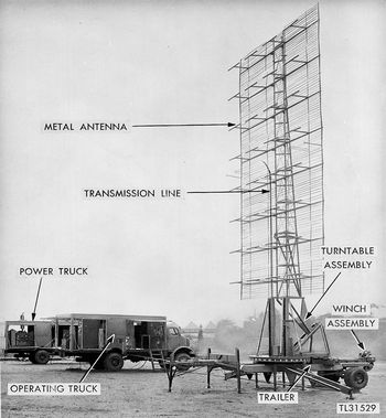 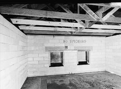 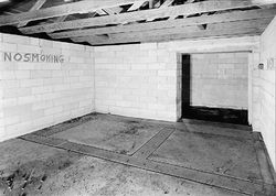 The radar antenna was positioned west of the north end of the radar operations building and connected via cables & transmission lines to the radar transmitter/receiver equipment in the operations building. The antenna was the SCR-270-B mobile version mounted on a towable trailer. The antenna could be folded flat for storage or transport. In operation, the antenna was unfolded and vertically extended with a triangular tower and antenna elements that resembled a large exposed bedspring.
Initially, the enlisted men were housed in the old Klamath Grange Hall in the nearby town of Klamath and transported by truck to the operations area for duty. By 1944 a cantonment area was constructed just a half mile south of the operations area. NPS documentation indicates that four "farmhouse" style buildings were constructed to house the troops at this site. These buildings no longer exist and the cantonment area is overgrown. ClosureThe site was deactivate in 1946.
Current StatusThe two main buildings remain intact externally with enough of the external features remaining to illustrate the deception of farm buildings but there is no interpretation of the individual buildings or the functions of the site. Both buildings are sealed up and not even a floor plan is provided to show how they were used. There is a reader board with some overview material up at the small parking area (room for two cars) along Coastal Drive where the access path to the site begins. The location of the cantonment area is not identified and the area has become so overgrown that we could not identify where the old access road entered. No buildings remain but there may be some foundational remains. We could not access the site because of the heavy brush.
See Also: Sources:
Links:
Visited: 11 May 2019, 8 May 2019
|
