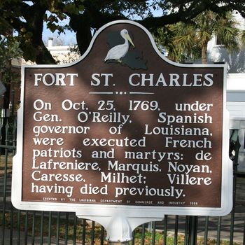
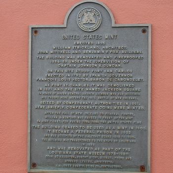
Fort St. Charles (1)
| More information at Warlike, Wikidata, Wikipedia
French Era (1754-1762)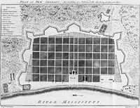 The French did not provide significant defenses for New Orleans until the French & Indian War put the city at risk of capture by British forces coming down the Mississippi River. Significant defenses were built in 1754 and improved in 1760. An earthworks with a moat enclosed the area known today as the French Quarter. Nine bastions protected the earthworks Conde's Bastion, Kerlerec's Bastion, St. Louis Bastion, Choiseul's Bastion, Orleans Bastion, Redan of the Bayou, Berry's Bastion, D'Abbadie's Bastion, and Charles' Bastion. The city square known as the Place d'Armes fronted and was open to the river as it is today. This portion of the defenses mounted twenty-one guns and it was said the city was protected by some 100 mounted guns.
Spanish Era (1762-1803)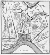 At the close of the French & Indian War France ceded parts of Louisiana to Spain in the secret Treaty of Fontainebleau (1762). The remainder of French claimed territory was ceded to Great Britain in the Treaty of Paris (1763). Spain neglected the New Orleans defenses until 1792 when a plan was approved by the Spanish Governor François Louis Hector, Baron de Carondelet to place five forts linked by embankments around the city. Again, the Place d'Armes was to be open to the river. The five forts were: Fort St. Jean, Fort St. Ferdinand, Fort Bourgogne, Fort San Luis and the largest, Fort San Carlos. The forts were five sided, built of brick and connected by a palisade. The two largest forts were placed at the river's edge and the three others were place at the back of the city. Each fort was designed with defenses on the inward side to counter any citizen or slave uprising from within the city.
Fort San Carlos was built in 1792 by the Spanish Governor François Louis Hector, Baron de Carondelet. In 1803 Spain ceded the Louisiana Territory to France who very quickly sold it to the United States in the Louisiana Purchase. United States Era (1803-1821)The Louisiana Purchase ceded vast western territory to the United States, including the present day State of Louisiana and the City of New Orleans. General James Wilkinson took possession of the territory for the United States on 20 Dec 1803 and on that date his troops occupied the five old Spanish forts in the City of New Orleans. Wilkinson's troops found the forts in bad condition and in the end, not worth saving. General Wilkinson's order book for 20 Dec 1803 recorded the following guard postings for the first day: 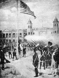
When the Americans arrived at the Spanish forts they found Fort St. Charles armed with fifteen 12 and 18-pounder cannons on rotting carriages. Fort St. Louis was found to have no ordnance in place and Fort Bourgogne, Fort St. John, and Fort St. Ferdinand were found to be defenseless. Fort St. Louis, Fort Bourgogne, Fort St. John, and Fort St. Ferdinand were ordered to be demolished between 1805 and 1812. Fort St. Charles survived as a barracks and ordnance depot until it was ordered demolished in 1821, the demolition being completed in 1826. The Fort St. Charles site was then named Jackson Square. The U.S. Mint building was built on the site in 1835 and the building was renovated and fire proofed in 1856-1859 by Captain Johnson K. Ducan (Cullum 1411). Current StatusNo aboveground remains of the fort, which was in the square bounded by Esplanade, Barracks, Decatur and North Peters streets. The old US Mint now occupies the site entirely. Markers at the site.
See Also: Sources:
Links: Visited: 9 Dec 2009
| ||||||||||||||||||||||||||||||||||||||||||||||||||||||||||||||||||||||||||||||||||||||||||||||||
