Fort Runyon
|
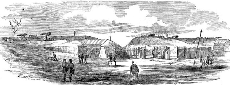
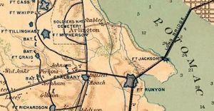
Fort Runyon (1861-1865) - A Union U.S. Civil War Fort first established in 1861 in Arlington County, Virginia. Named Fort Runyon after Brigadier General Theodore Runyon whose New Jersey Brigade troops helped build the fort. Abandoned in 1865 at the end of the war. History of Fort RunyonOne of the ring of Union fortifications surrounding Washington DC during the U.S. Civil War, see Washington DC Fort Ring. Fort Runyon was also one of 33 forts on the Virginia side of the Potomac River that made up an outer defense line for Washington DC known as the Arlington Line.This fort was also one of three forts built to protect the Long Bridge over the Potomac River from Virginia to Washington DC (Fort Albany, Fort Runyon and Fort Jackson). These forts were built early in the war and were the first line of defense for the Virginia end of the bridge. As the war progressed the line of defenses moved further south into Virginia and these forts became far less important and their garrisons were reduced. Fort Runyon and Fort Jackson were built on the road(s) to the bridge and Fort Albany was built later to protect the other two. Construction on Fort Runyon began on 24 May 1861, very early in the war. The post was built astride an important junction of three roads, one of which led directly to the Long Bridge. The fort had a perimeter of some 1,484 yards and completely enclosed the important junction forcing all traffic to the bridge to pass through the fort gates. This post was said to be the largest in the Defenses of Washington, roughly the size of the present day Pentagon. Construction was supervised by Captain Barton S. Alexander, (Cullum 1117), U.S. Corps of Engineers and was completed in about seven weeks. As the defense line moved further into Virginia the fort declined in importance and the garrison was reduced in size and the role became simply checking traffic into the city. By 1862 most of the armament had been relocated to other forts and only one 8" seacoast howitzer and one 32 pounder cannon remained. The fort was abandoned in 1865 at the end of the war.
Current StatusNo visible remains. A marker was placed in 1988 but may no longer be in place.
See Also:
Sources:
Links: Visited: No
| ||||||

