Fort Loudoun (2)
|
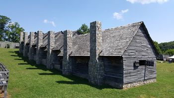
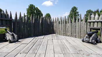
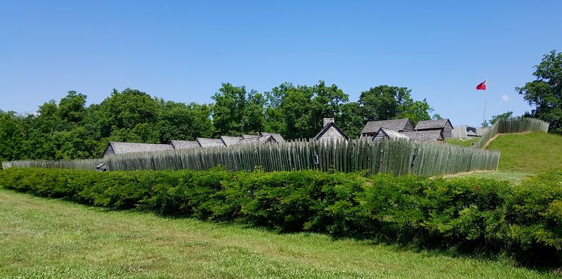
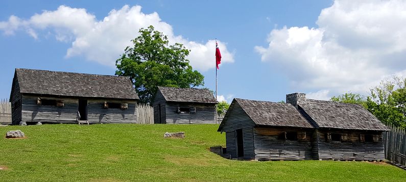
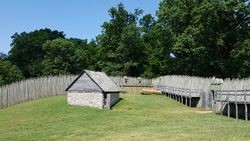
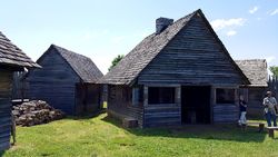
Fort Loudoun (2) (1756-1760) - A British Colonial French & Indian War fort established in 1756 near present-day Vonore, Monroe County, Tennessee. Named for John Campbell, fourth Earl of Loudoun. Besieged by hostile Indians in 1760, surrendered to and burned down by them seven months later. Also spelled as Fort Loudon. HistoryEstablished in 1756 by General Andrew Lewis, chief engineer of the British troops as the first structure built in present-day Tennessee. Built at the request of the Overhill Indians for protection from the French during the French & Indian War. The site of the Cherokee town of Tuskegee lay in the valley south of the fort now covered by Tellico Lake. Fort Loudoun was built as a large diamond-shaped defense, palisaded with a platformed bastion at each of the four angles and a raveline at the entrance. It was surrounded by a dry moat filled with young honey locust trees that produced four-inch thorns and acted like today's barbed wire. Chevaux de Frise was employed to cover the entrances and any other gaps in the locust tree hedge. Within the fort was the commanding officer's house, barracks for the troops, a stone magazine, the officer of the day/guardhouse buildings, a commissary building, and other support buildings. The Sally Port was located on the north side while the main gate was located on the south-facing the Indian village. Each of the bastions was platformed with embrasures for two cannons and each was named. The northwest bastion was the King's Bastion, the southwest was the Duke of Cumberland Bastion, the southeast was the Queen's Bastion and the northeast was the Prince of Wales Bastion. The flag was located in the Prince of Wales bastion, the high point in the post. The interior of the post was on a rather steep slope down from the north side to the south and, at that time, the post was on a bluff overlooking the Cherokee village.
Anglo-Cherokee WarAfter the murder of several Cherokee chiefs, the Cherokee became hostile and they laid siege to the fort in February 1760. After seven months the garrison was forced to surrender with a promise of safe passage to Fort Prince George (3). The Indians reneged, killing some of the survivors and taking the remainder hostage. The hostages were later ransomed and delivered to Fort Prince George (1). The fort was burned to the ground by the Indians and was not rebuilt. The fort site was rediscovered and excavated in the 1930s. The WPA began restoration of parts of the fort in 1937 and the restoration was completed in the 1960s. The replica is built over the original site but, because dams along the Little Tennessee River raised the river level, the replica fort is some 17 feet above the level of the original fort.
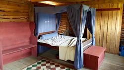
Current StatusMust See! Fort Loudoun State Historic Park, Vonore, Monroe County, Tennessee. Reproduction of the fort and several markers. Zoom out to see the marker map points and the Visitor Center/Museum location. The site includes a small visitor center/museum with displays and models for both Fort Loudoun and the Tellico Blockhouse across the water. Most of the fort buildings are fitted out with period-correct furnishings and present a view into life at the fort. Some nine times a year reenactors are present over a weekend to provide a better view of the life, dress, and occupations of the fort occupants. The southwest bastion contains two display cannons, one of which is fired periodically when the reenactors are present. A large British colonial flag is flown over the fort.
See Also: Sources:
Visited: 22 May 2016
| ||||||
