Fort Seybert
|
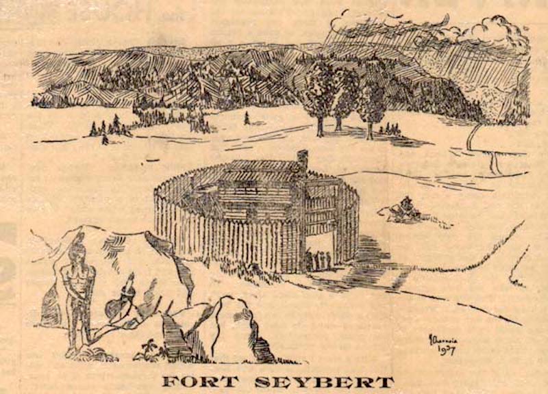
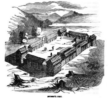
Fort Seybert (1755-1763) - A French & Indian War Fort established in 1755 in the town of Fort Seybert, Pendleton County, West Virginia. Named Fort Seybert after Captain Jacob Seybert. Abandoned in 1763. Also Known as Seybert's Fort and later Fort Blizzard HistoryFort Seybert was built on the South Fork of the South Branch of the Potomac River next to John Patton's Mill. Patton sold the land in 1755 to Jacob Seybert. With the reemergence of Indian Attacks, Jacob Seybert constructed a settler refuge that consisted of a central two-story blockhouse surrounded by a 90' circular stockade. The central blockhouse was about 21 feet square. On 16 Mar 1757, Jacob Seybert was commissioned a Captain of Militia. The AttackFort Seybert was attacked by hostile Indians on the morning of 28 Apr 1758 when a number of the men were away from the fort. With a shortage of ammunition in the fort and just a few adult males, Captain Seybert, faced with a no-win situation, surrendered after promises by the war chief Bemino that their lives would be spared. Bemino did not keep his promises and the Indians massacred some 19 settlers and took 11 of them captive after the surrender. The MassacreCaptain Seybert's son, who was one of the captives, later described the massacre: They bound ten, whom they conveyed without the fort, and then proceeded to massacre the others in the following manner: They seated them in a row upon a log, with an Indian standing behind each; and at a given signal, each Indian sunk his tomahawk into the head of his victim: an additional blow or two dispatched them. The Indians then burned down the fort and carried off the captives. The Second FortThe fort was rebuilt by the Virginia Colonial Militia in 1758 as a larger stockade with four blockhouses, known as Fort Seybert. In 1768 after the Blizzard family purchased the property, it became known as Fort Blizzard. Abandoned as a fortification at the end of the French & Indian War in 1763 but the site may have been used During the Revolutionary War era (1775–1783).
Current StatusUnknown.
See Also: Sources:
Links:
Fortification ID:
Visited: No
|

