File:Yorke Island Map.jpg
From FortWiki
Size of this preview: 790 × 600 pixels.
Full resolution (2,128 × 1,616 pixels, file size: 1.24 MB, MIME type: image/jpeg)
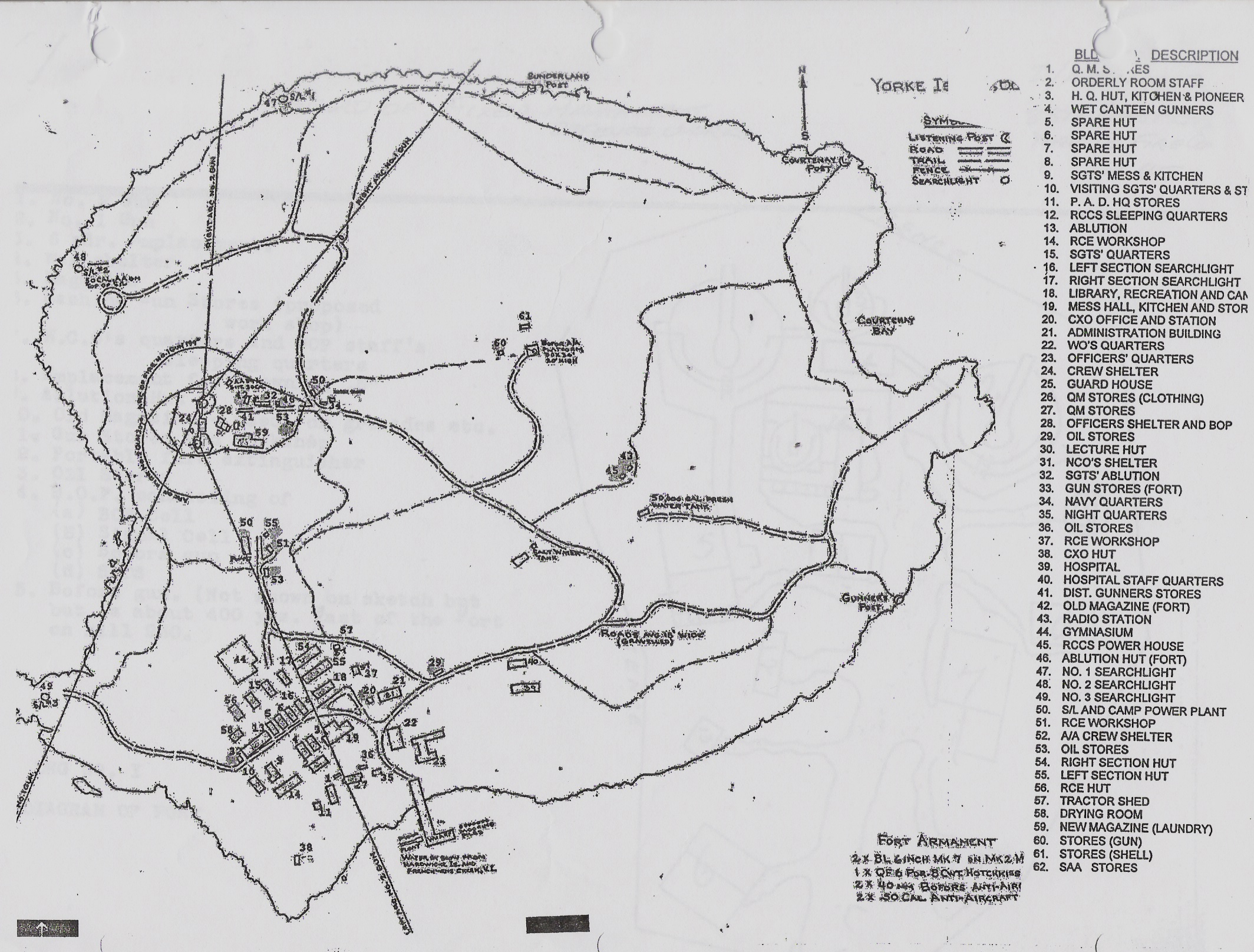
Historical Map of Yorke Island with all buildings, Period Map; Canadian Engineer Survey 1942. From Wikimedia Commons, https://commons.wikimedia.org/wiki/File:Death_of_General_Pike_at_the_Battle_of_York.jpg
File history
Click on a date/time to view the file as it appeared at that time.
| Date/Time | Thumbnail | Dimensions | User | Comment | |
|---|---|---|---|---|---|
| current | 10:54, 9 July 2016 | | 2,128 × 1,616 (1.24 MB) | Bill Thayer (Talk | contribs) | Historical Map of Yorke Island with all buildings, Period Map; Canadian Engineer Survey 1942. From Wikimedia Commons, https://commons.wikimedia.org/wiki/File:Death_of_General_Pike_at_the_Battle_of_York.jpg |
- Edit this file using an external application (See the setup instructions for more information)
File usage
The following page links to this file: