File:Topo Plan of East Point MR JB.jpg
From FortWiki

Size of this preview: 432 × 599 pixels.
Full resolution (1,443 × 2,000 pixels, file size: 431 KB, MIME type: image/jpeg)
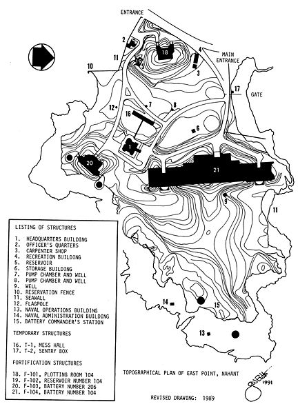
East Point MR Topo Plan, drawing by Jerry Butler
File history
Click on a date/time to view the file as it appeared at that time.
| Date/Time | Thumbnail | Dimensions | User | Comment | |
|---|---|---|---|---|---|
| current | 15:58, 6 December 2011 | | 1,443 × 2,000 (431 KB) | John Stanton (Talk | contribs) | East Point MR Topo Plan, drawing by Jerry Butler |
- Edit this file using an external application (See the setup instructions for more information)
File usage
The following page links to this file: