File:Site Plan Annotated.jpg
From FortWiki
Size of this preview: 800 × 534 pixels.
Full resolution (1,175 × 784 pixels, file size: 492 KB, MIME type: image/jpeg)
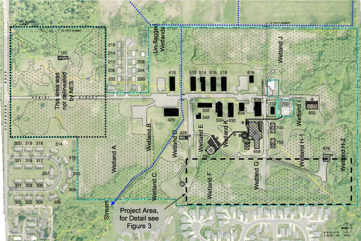
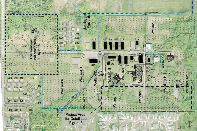
Existing Conditions and Wetlands Map, Bay Horizon Park/Watcom County Parks Mitigation Report, Figure 2, May 2009, annotated with building numbers.
File history
Click on a date/time to view the file as it appeared at that time.
| Date/Time | Thumbnail | Dimensions | User | Comment | |
|---|---|---|---|---|---|
| current | 00:29, 23 August 2015 | | 1,175 × 784 (492 KB) | John Stanton (Talk | contribs) | Existing Conditions and Wetlands Map, Bay Horizon Park/Watcom County Parks Mitigation Report, Figure 2, May 2009, annotated with building numbers. |
- Edit this file using an external application (See the setup instructions for more information)
File usage
The following page links to this file: