File:Map1755-dauphin.jpg
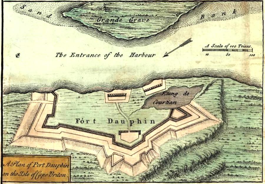
Fort Dauphin Cape Breton (inset) from "A new and accurate map of the English empire in North America, 1755"
Fort Dauphin (3) (1713 to 1758) - A French military colonial fort located at present-day Englishtown, Victoria County, Nova Scotia, Canada.
After Queen Anne's War, French officer Jean-Baptiste Hertel de Rouville and others established Fort Dauphin in 1713 as the capital of Ile Royale, prior to the establishment of Louisbourg. (Hertel led the Raid on Deerfield and military operations against the English in Newfoundland.) He played a role in the early settlement of both present-day Englishtown (1719-1722) and St. Peter's (1713-1718). He died at Fort Dauphin.
As commodore of the fleet, Edward Tyng led 13 armed vessels and about 90 transports in the successful Siege of Louisbourg (1745). He participated in the Capture of the Vigilant and the destruction of Port Dauphin (Englishtown) in June 1745, burning 40 houses and an equal number of vessels.
From the Dictionary of Canadian Biography Online: The fort was occupied from 1713 to 1758. Fort Dauphin was built adjacent to the former Fort Sainte Anne (later rebuilt as Simon Denys Fort.
File history
Click on a date/time to view the file as it appeared at that time.
| Date/Time | Thumbnail | Dimensions | User | Comment | |
|---|---|---|---|---|---|
| current | 16:24, 17 December 2017 | | 900 × 625 (140 KB) | Ken Heaton (Talk | contribs) | Fort Dauphin Cape Breton (inset) from "A new and accurate map of the English empire in North America, 1755" Fort Dauphin (3) (1713 to 1758) - A French military colonial fort located at present-day Englishtown, Victoria County, Nova Scotia, Canada. Af... |
- Edit this file using an external application (See the setup instructions for more information)
File usage
The following page links to this file: