File:La Pointe Fort Locations (1).png
From FortWiki
Size of this preview: 800 × 553 pixels.
Full resolution (1,431 × 989 pixels, file size: 2.17 MB, MIME type: image/png)
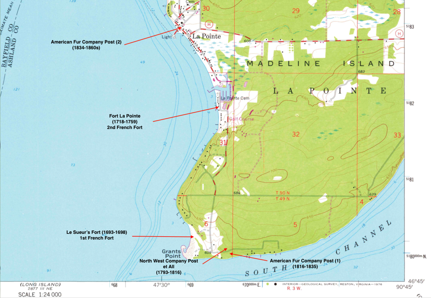
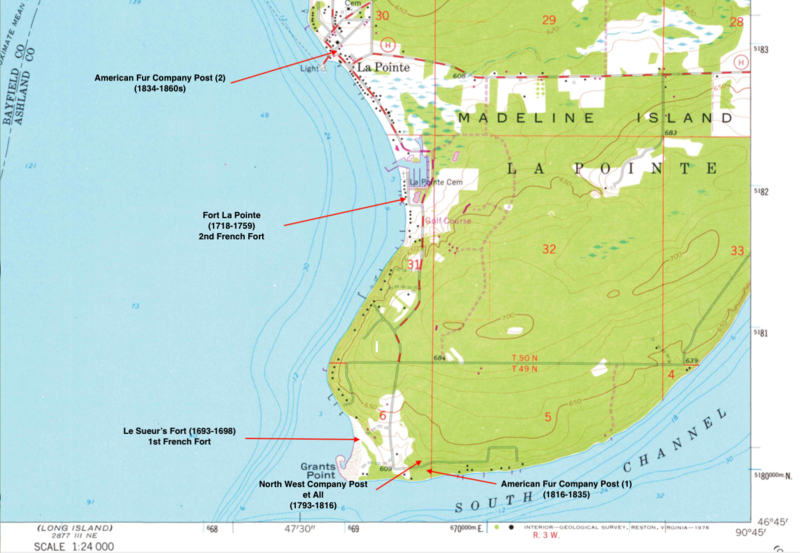
USGS Map Snippet of Madeline Island, WI, Showing Fort & Post Locations. (After Ross)
File history
Click on a date/time to view the file as it appeared at that time.
| Date/Time | Thumbnail | Dimensions | User | Comment | |
|---|---|---|---|---|---|
| current | 01:58, 10 February 2019 | | 1,431 × 989 (2.17 MB) | John Stanton (Talk | contribs) | USGS Map Snippet of Madeline Island, WI, Showing Fort & Post Locations. (After Ross) |
- Edit this file using an external application (See the setup instructions for more information)
.png&action=edit&externaledit=true&mode=file)
File usage
The following page links to this file:
.png&oldid=128945)
.png)
.png&action=edit&redlink=1)
.png&action=edit)
.png&action=history)
.png)
.png)
.png&printable=yes)
.png&oldid=128945)