File:Fort Buxton Location Map.jpeg
From FortWiki
Size of this preview: 732 × 600 pixels.
Full resolution (2,000 × 1,638 pixels, file size: 632 KB, MIME type: image/jpeg)
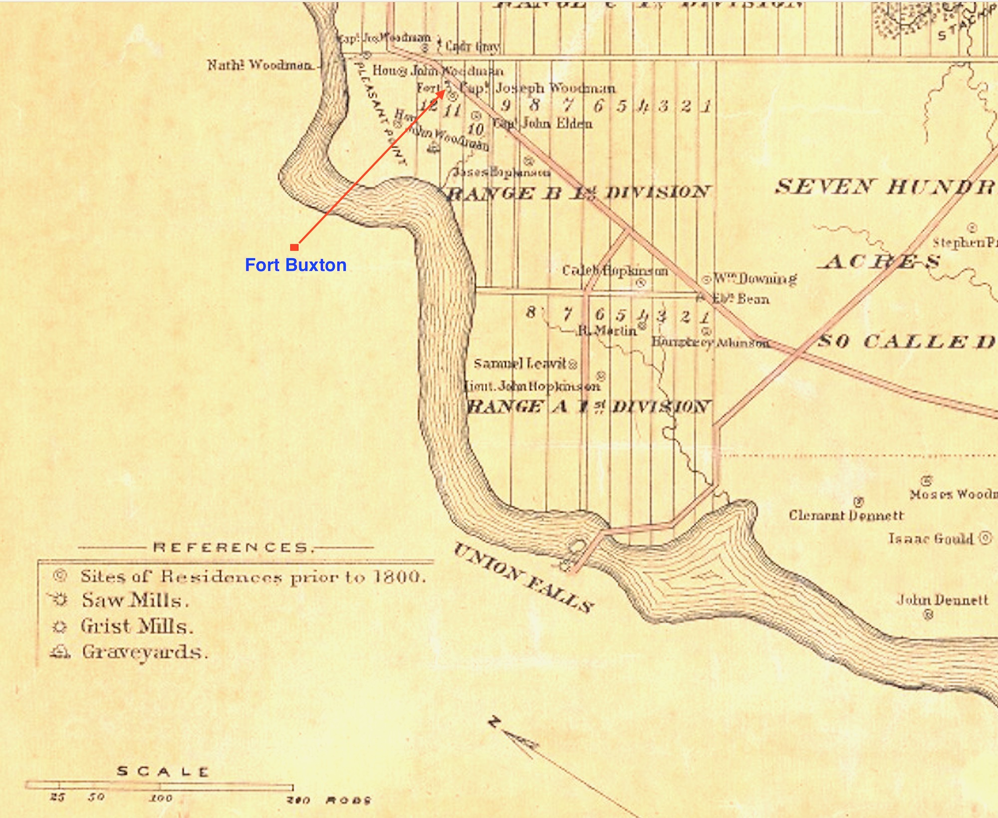
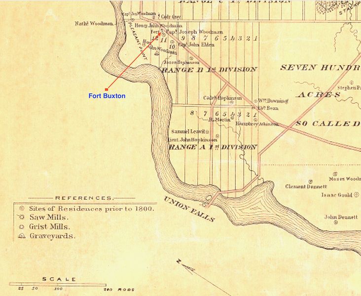
Fort Buxton Location Map, public domain, Map of Buxton, Maine by Daniel Dennet, 1870.
File history
Click on a date/time to view the file as it appeared at that time.
| Date/Time | Thumbnail | Dimensions | User | Comment | |
|---|---|---|---|---|---|
| current | 03:38, 27 March 2020 | | 2,000 × 1,638 (632 KB) | John Stanton (Talk | contribs) | Fort Buxton Location Map, public domain, [https://brbl-dl.library.yale.edu/vufind/Record/4200955 Map of Buxton, Maine by Daniel Dennet, 1870.] |
- Edit this file using an external application (See the setup instructions for more information)
File usage
The following page links to this file: