File:Custer AFS Radar Site.png
From FortWiki
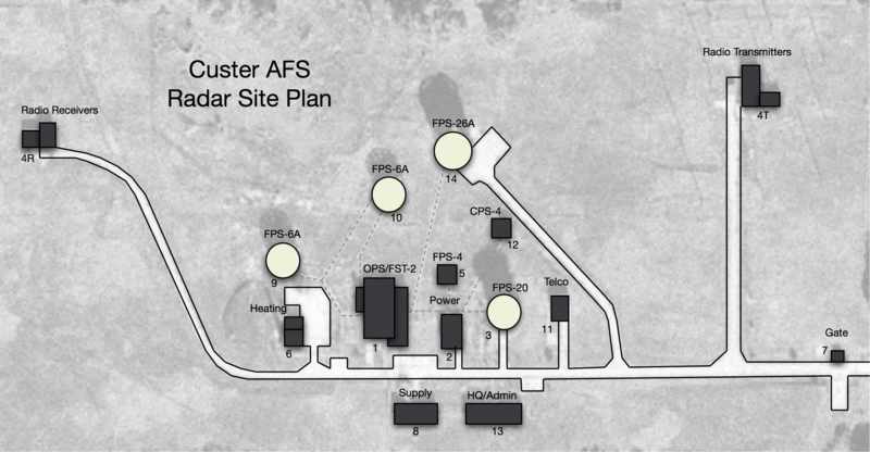
Size of this preview: 800 × 416 pixels.
Full resolution (2,282 × 1,188 pixels, file size: 2.07 MB, MIME type: image/png)
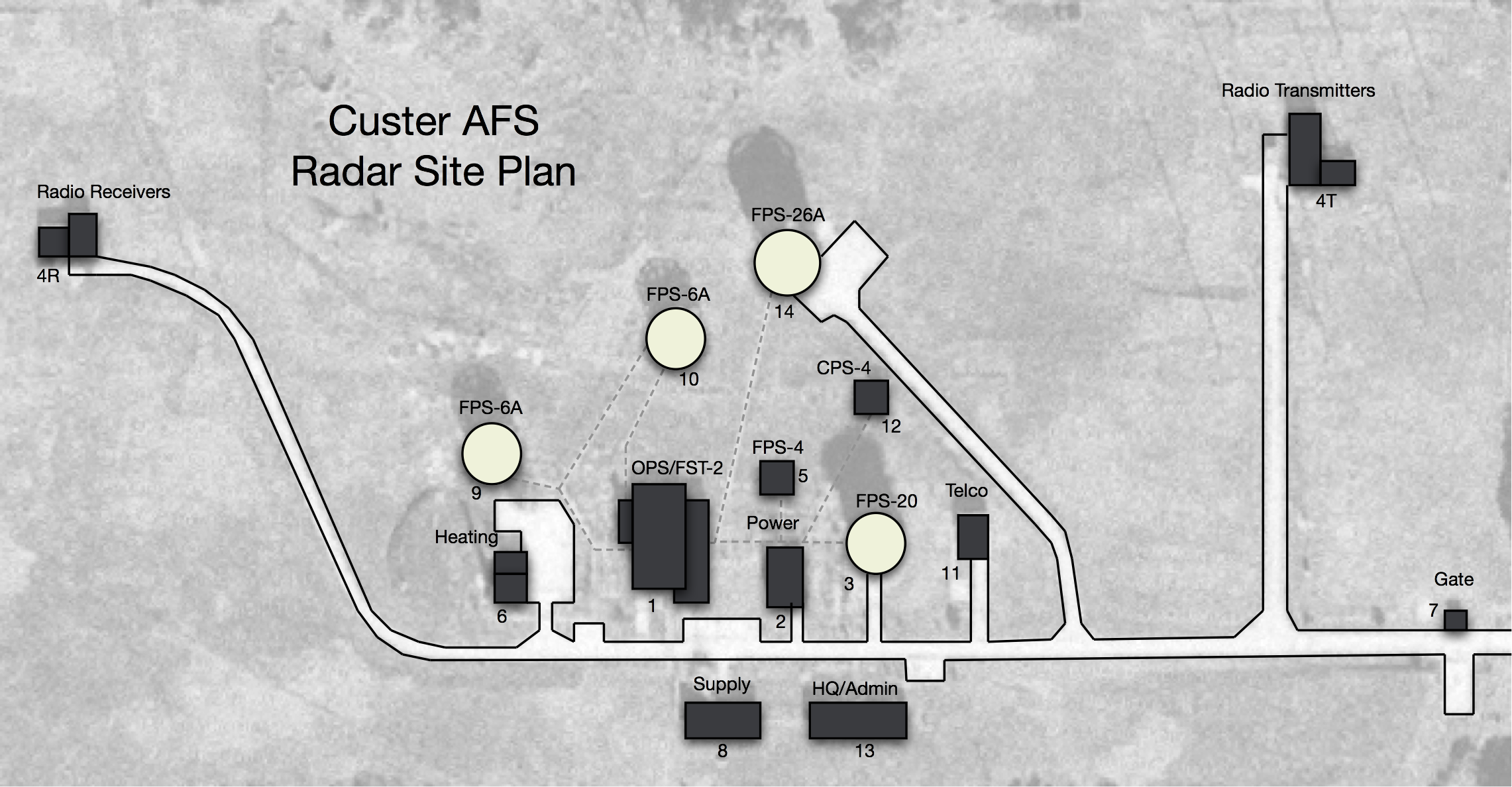
Custer AFS Radar Site Plan, drawing by John Stanton 11 Sep 2015
File history
Click on a date/time to view the file as it appeared at that time.
| Date/Time | Thumbnail | Dimensions | User | Comment | |
|---|---|---|---|---|---|
| current | 03:54, 12 September 2015 | | 2,282 × 1,188 (2.07 MB) | John Stanton (Talk | contribs) | Custer AFS Radar Site Plan, drawing by John Stanton 11 Sep 2015 |
- Edit this file using an external application (See the setup instructions for more information)
File usage
The following page links to this file: