Fort Correctionville
|
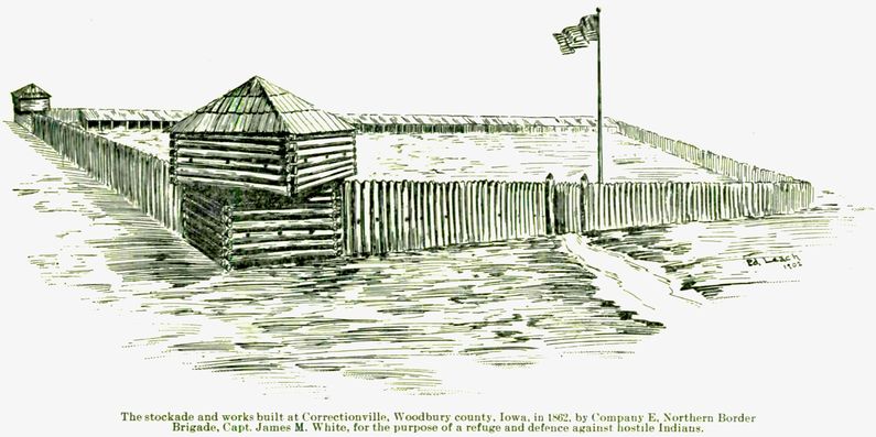
Fort Correctionville (1862-1863) - A U.S. Civil War era Fort established in 1862 by the State of Iowa in response to the 1862 Sioux uprising. The fort was located in Correctionville, Woodbury County, Iowa. Also known as Fort White (2) and Correctionville Stockade Abandoned in 1863. HistoryLocated in Correctionville, Woodbury County, Iowa. This fort and five others were established in Iowa as a result of the 1862 Sioux Indian uprising and the slaughter of some 800 settlers by raiding Sioux warriors in August 1862. This line of forts provided large stockades to hold local settlers during times of Indian alarm. Each of the forts was manned by a detachment of troops of the Northern Iowa Border Brigade (militia), who were organized by the Iowa governor to deal with the crisis. Captain James M. White was commissioned as Commander of Company E, who was posted to Correctionville to build and garrison Fort Correctionville. The buildings at Fort Correctionville were made of heavy 12" square timbers. The stockade was made with split logs set upright in the ground. The stockade gate was made of hewed timber 5" thick. The configuration of the stockade is said to have been a large triangle, one of three Iowa stockades to be built as a triangle. The sketch above shows the fort with a four-sided Stockade. The walls were 121 feet long and were covered with lime. The blockhouse in the fort was a two-story building. It was located in the southeast corner, although there is some dispute about its location. The second story was set crosswise on the first story and was 16-foot square. The fort well was 60' deep and curbed with hackberry wood. This well has been located and has been used to better identify the location of the fort to archeologist as being along Birch Street on the southwest side of Correctionville.
Current StatusNo visible remains, archaeological site 13WD72.
See Also: Sources:
Links: Visited: 29 Jul 2020
| |||||||
