Battery Pennington
|
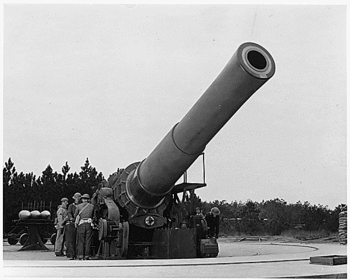
Battery Pennington (1922-1947) - Battery Pennington was an open plan, 16 inch coastal howitzer battery on Fort Story, Virginia. The battery was named in G.O. 13, 27 Mar 1922, after BG Alexander Cummings McWhorter Pennington, Jr., (Cullum 1864), 2nd U.S. Artillery, U.S. Civil War veteran, who died 30 Nov 1917. Battery construction was approved 29 Apr 1921, began in July 1921, was completed on 5 Jul 1922 and transferred to the Coast Artillery for use 21 Oct 1922. Total cost of the accepted battery minus armament was $332,174.23. The howitzers were mounted between September 1922 and 20 Oct 1924. Gun emplacements 3 and 4 were renamed Battery Walke for BG Willoughby Walke, (Cullum 2984), in 1940. The Battery was deactivated in 1947.
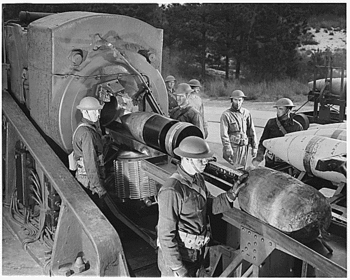
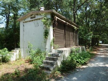
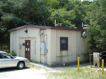
HistoryPart of the Harbor Defense of Chesapeake Bay. Originally built as a coastal gun battery with four 16" M1920 howitzers mounted on M1920 howitzer carriages. 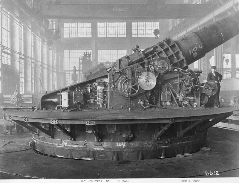 Four circular open concrete pads each connected to two sets of magazines and shell rooms formed the battery infrastructure. Two detached powerhouses furnished electrical power to the Battery. Standard gauge railroad tracks and switches connected the magazines, shell rooms and the gun emplacement together and the gun emplacements were also connected by the rail system so any set of magazines and shell rooms could service any gun emplacement. The Battery rail system was then connected to the Norfolk Southern Railroad tracks for resupply of munitions and armament. The shell rooms were designed so that the rail tracks ran down through the middle of the building facilitating the loading of the heavy 16" shells directly onto the rail shell carriers. The magazines were designed so that rail tracks ran on each side of the building and three roll-up steel doors on each side gave handlers easy access to the large powder bags. Behind gun emplacement #3, a 280-foot tunnel through a large sand dune led to a combination plotting room and switchboard room. This tunnel was 15' high and 14' wide with railroad tracks through it, allowing railroad artillery to be sheltered inside. Operationally, the Battery was divided into two batteries of two howitzers each and they were originally called Battery Penningington A and B. Each of the batteries had its own separate plotting room. Gun emplacements 3 and 4 were renamed Battery Walke for BG Willoughby Walke, (Cullum 2984), in 1940.
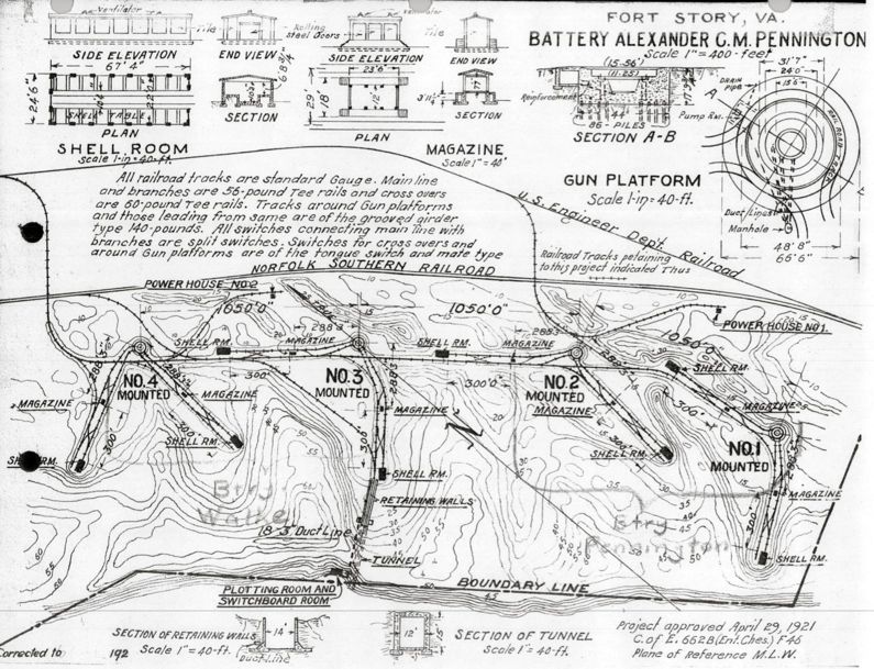
Current StatusNo period guns or mounts in place. Many of the support buildings survive but the rail system is removed. Most of the surviving emplacement #4 structures are in the base RV park and readily accessible. The surviving emplacement #3 structures are around a part of the post housing. The surviving emplacement #1 and #2 structures are mostly in a restricted training area and not accessible.
Sources:
Links: Visited: 21-27 Jul 2010
| |||||||||||||||||||||||||||||||||||||||||||||||||||||||||||||||||||
